
Features Flurnamenatlas
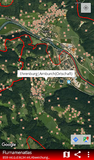
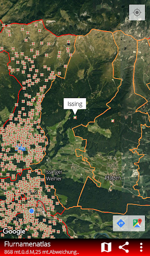
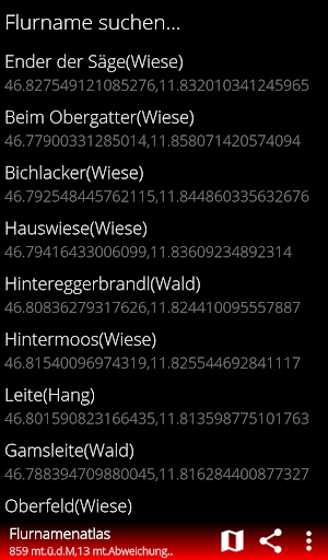
Tyrol / South Tyrol With this field name atlas it is possible to digitally access around 170,000 historical field names from all over South Tyrol and all municipal and cadastral boundaries.
All data can be imported and displayed in a map for free.
The user himself determines which background map is used by Google Maps.
Autostart can be used to determine which field names and cadastral boundaries are displayed.
Your own points (POIs) can be saved and saved in your own list.
Your own position can be sent to other users.
This option can be particularly helpful for hunters and hikers.A practical function is distance measurement via GPS positioning.
By pressing and holding on the map, the distance from your own position to the selected point can be calculated exactly.
The straight line distance between point and point is also easy to determine.
The display of sea level and the accuracy of the location determination are further practical functions.
Sources: State cartography of the province of South Tyrol, book "Country names, roots of the homeland - Ehrenburg, Kiens, St.Sigmund, Hofern and Getzenberg", published in 2010 by the Ehrenburg rifle company.
ISBN:9788897053095
Gaming Features
Enjoy immersive gaming experience with various game modes.
Fitness Tracking
Track your workouts and monitor your health metrics.
Travel Features
Plan and manage your travels with ease.
See the Flurnamenatlas in Action
Get the App Today
Available for Android 8.0 and above